Port Colborne sits at the southern entrance to the Welland Canal, where Great Lakes freighters transition between Lake Erie and Lake Ontario. This walk moves from a quiet Anglican church along Charlotte Street to the canal promenade, across the lift bridge, and into the extensive grounds of the Port Colborne Historical and Marine Museum. It’s a compact route, but layered with industrial, maritime, and early settler history.
Port Colborne was originally called Gravelly Bay before being renamed for Sir John Colborne, Lieutenant Governor of Upper Canada in the 1830s. The town developed rapidly when the Welland Canal reached Lake Erie in 1833, bringing ship traffic and trade to the small settlement. Looking along Charlotte Street: church wall, trimmed grass, and mature trees lining the sidewalk.
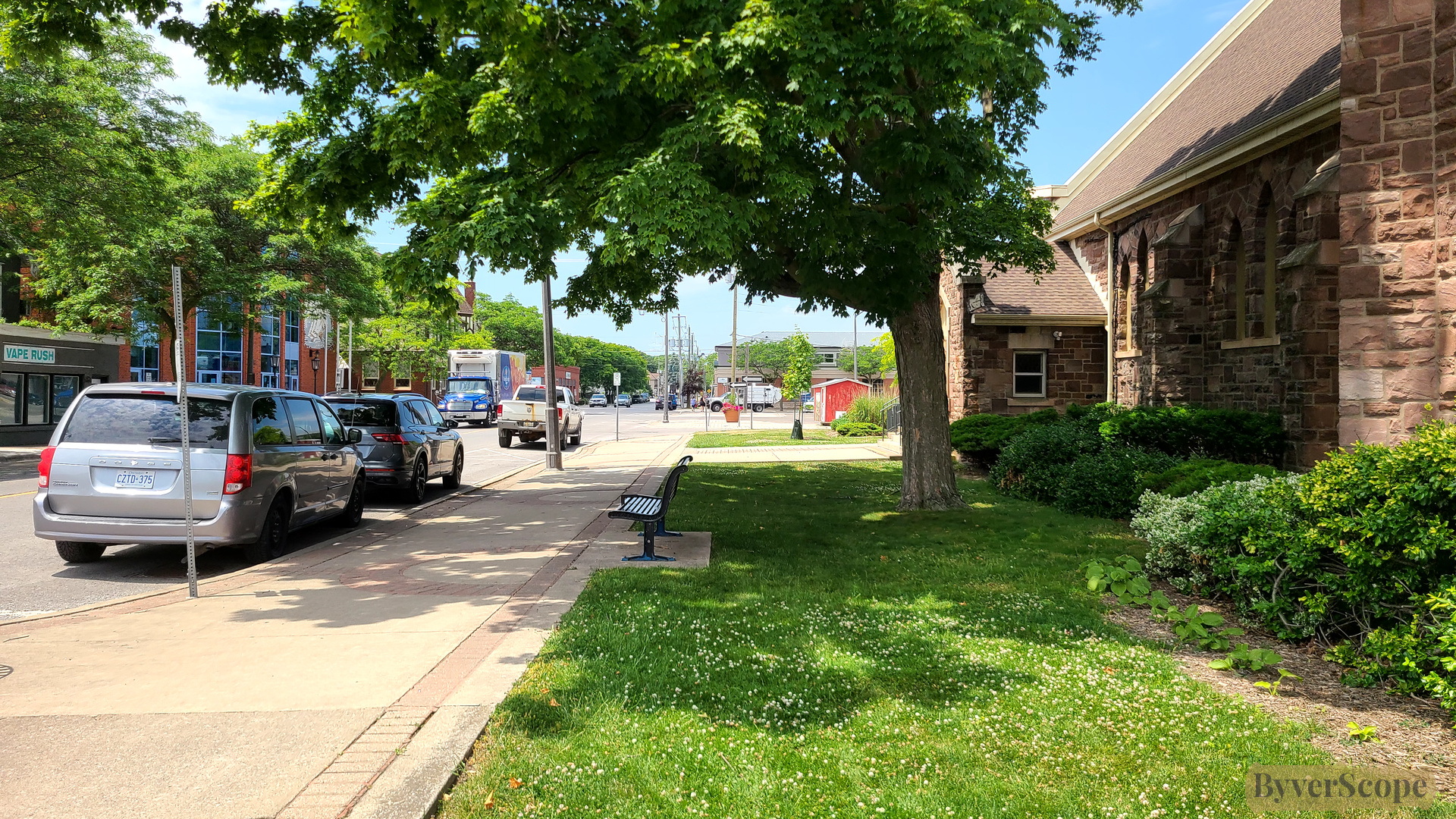
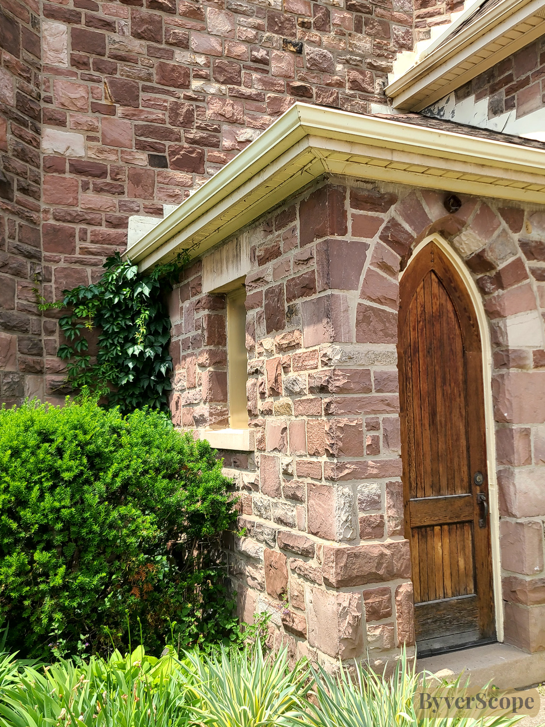
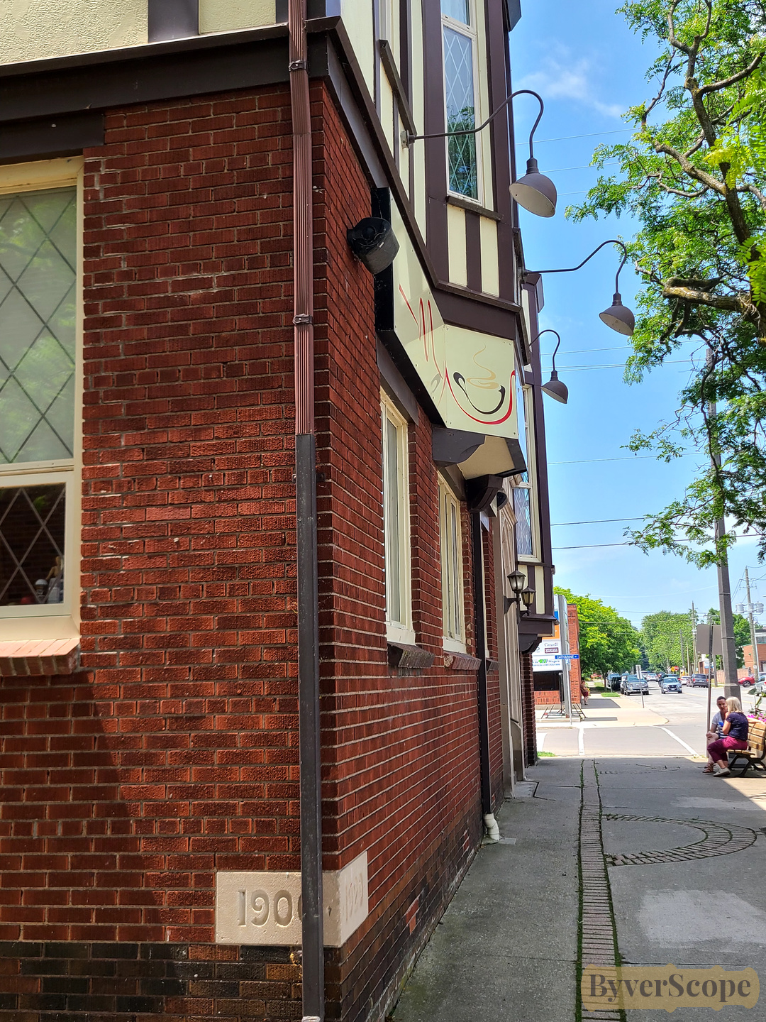
Wall textures of the street: (Left) Stone wall and pointed doorway of St. James & St. Brendan Anglican Church — ivy and plantings soften the Gothic lines. (Right) Corner of the St. James Guild Hall (early version of town community center used for church events, meetings, amateur theatre, and social dances), dated early 1900s — red brick and restrained detailing.
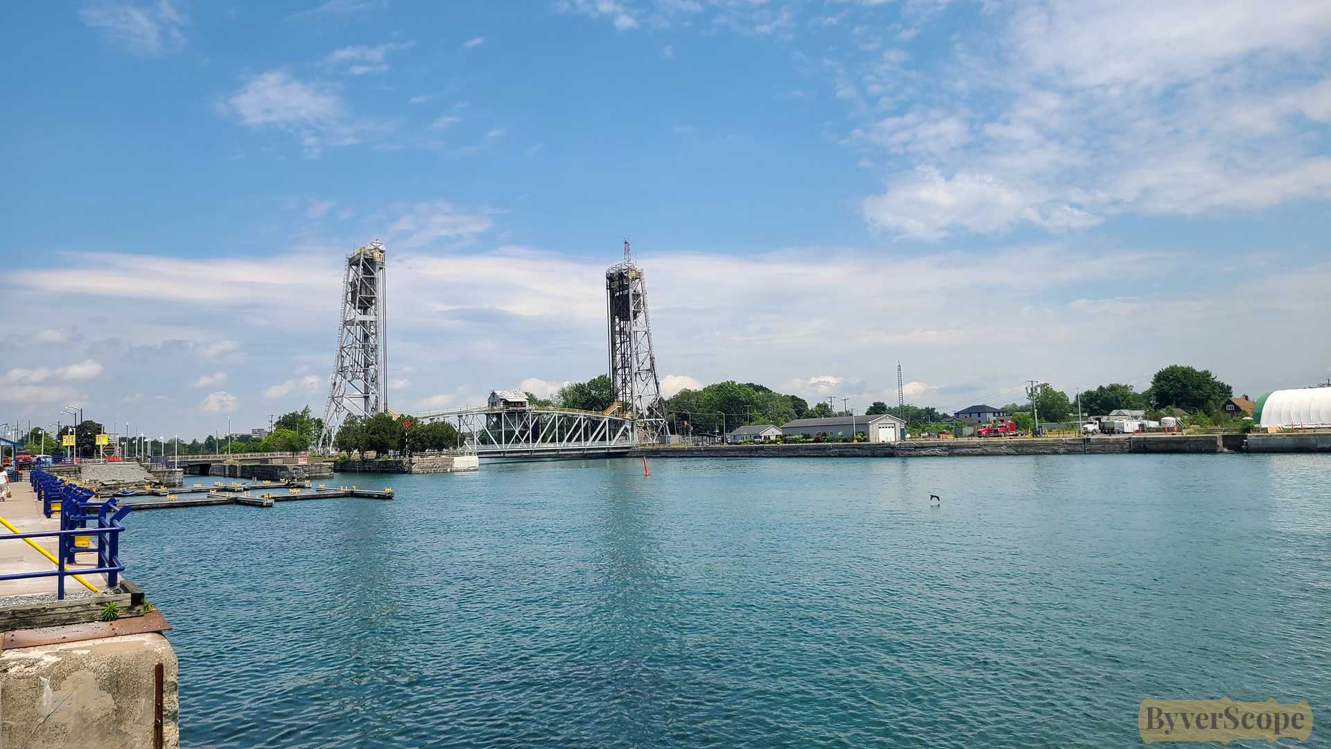
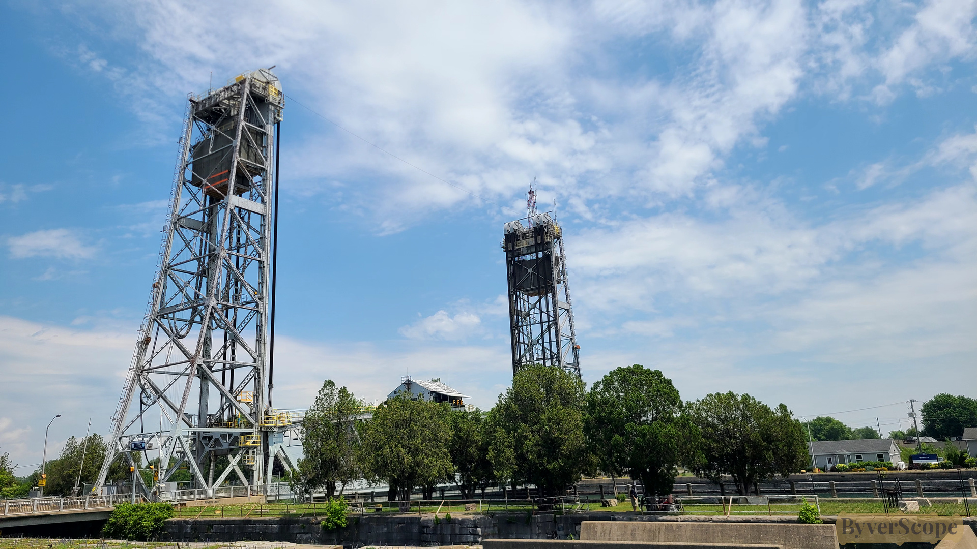
First view of the Clarence Street lift bridge from the Promenade — steel towers rising over the canal. The Clarence Street Bridge (Bridge 21) was built 1927–1929 during construction of the fourth Welland Canal. It lifts about 36.5 m (120 ft) to allow ships to pass, using huge counterweights and electric motors. Raising or lowering the bridge takes roughly 90 seconds.
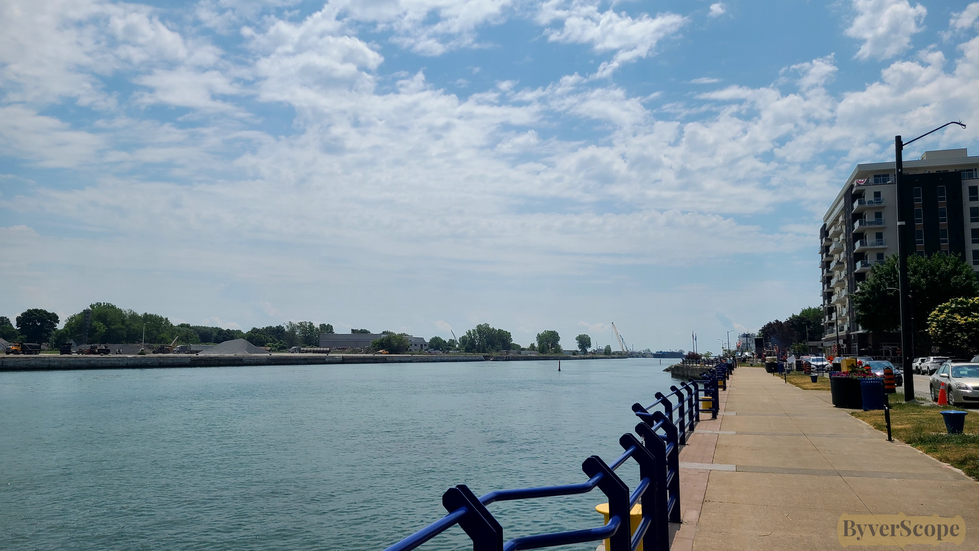
Looking south along the canal: calm water, promenade path, buildings under wide sky.
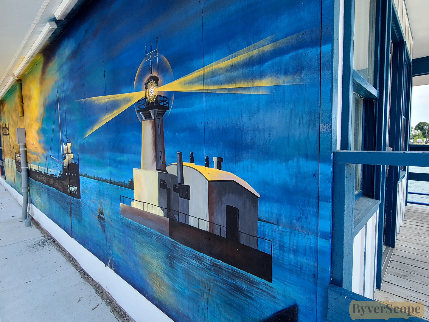
Lighthouse mural brightens a canal-side wall — maritime identity in paint.
Closer to the lift bridge: twin towers that elevate the roadway when ships are passing underneath.
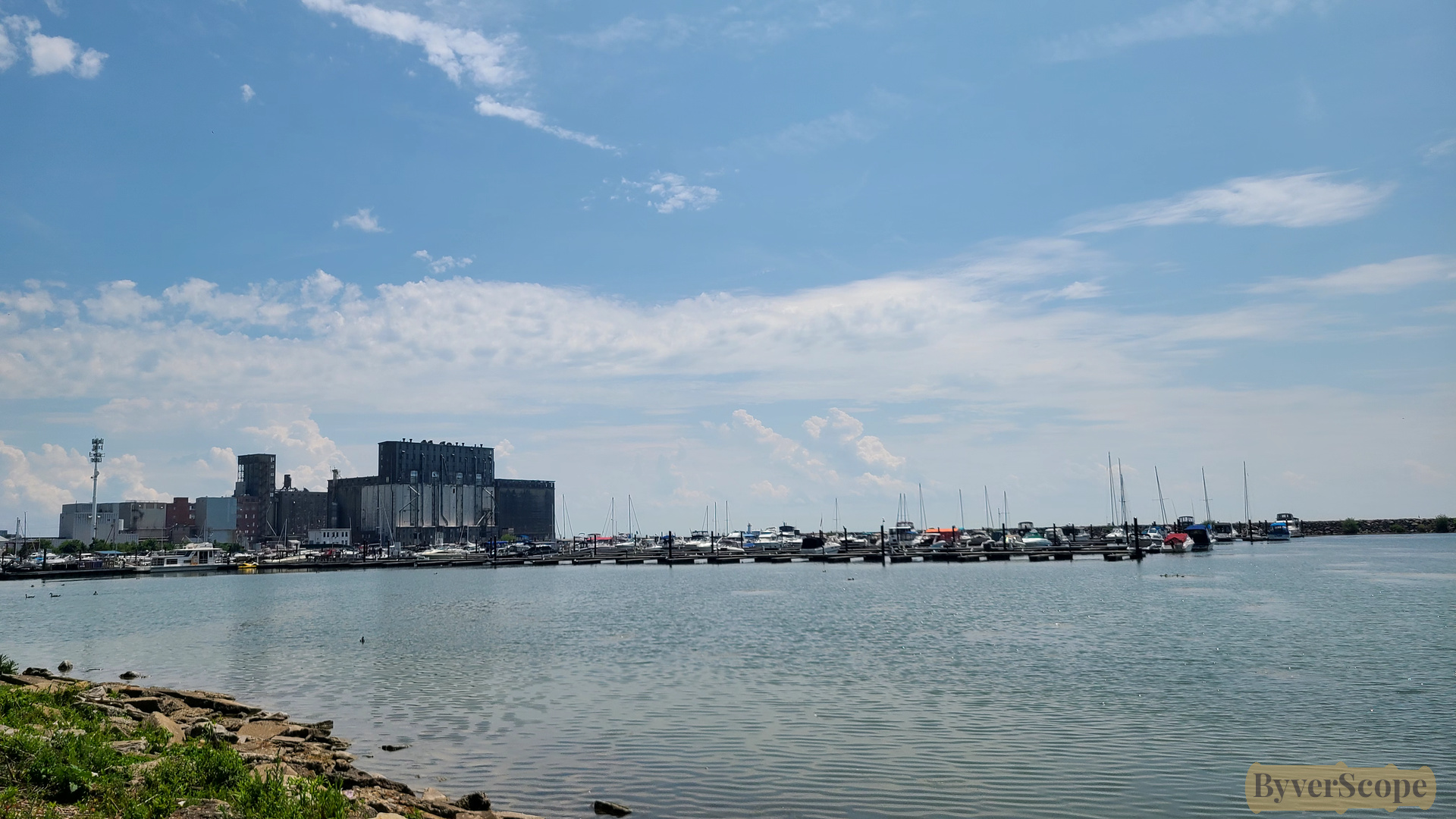
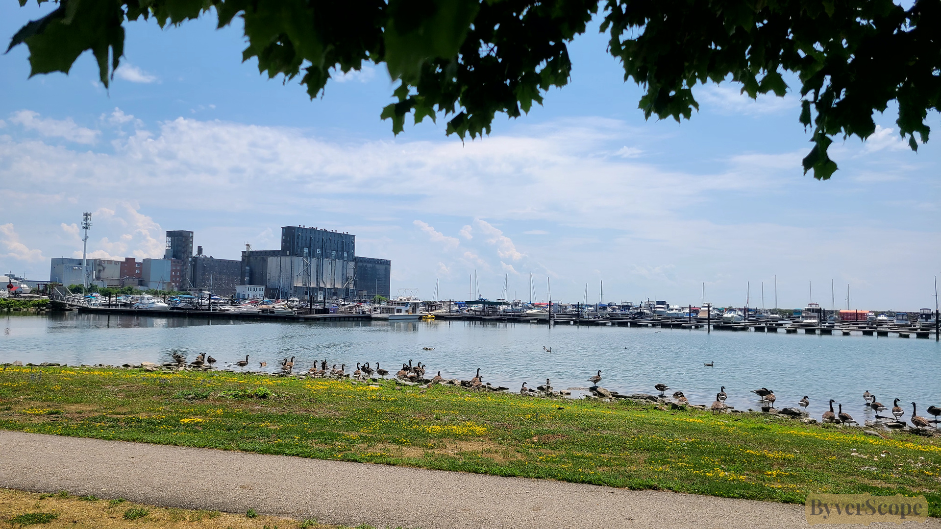
Gravelly Bay and marina — boats moored with grain elevators and industry beyond.
Path along the shoreline in H.H. Knoll Lakeview Park: ducks and geese at the shoreline, leaves framing the harbour.
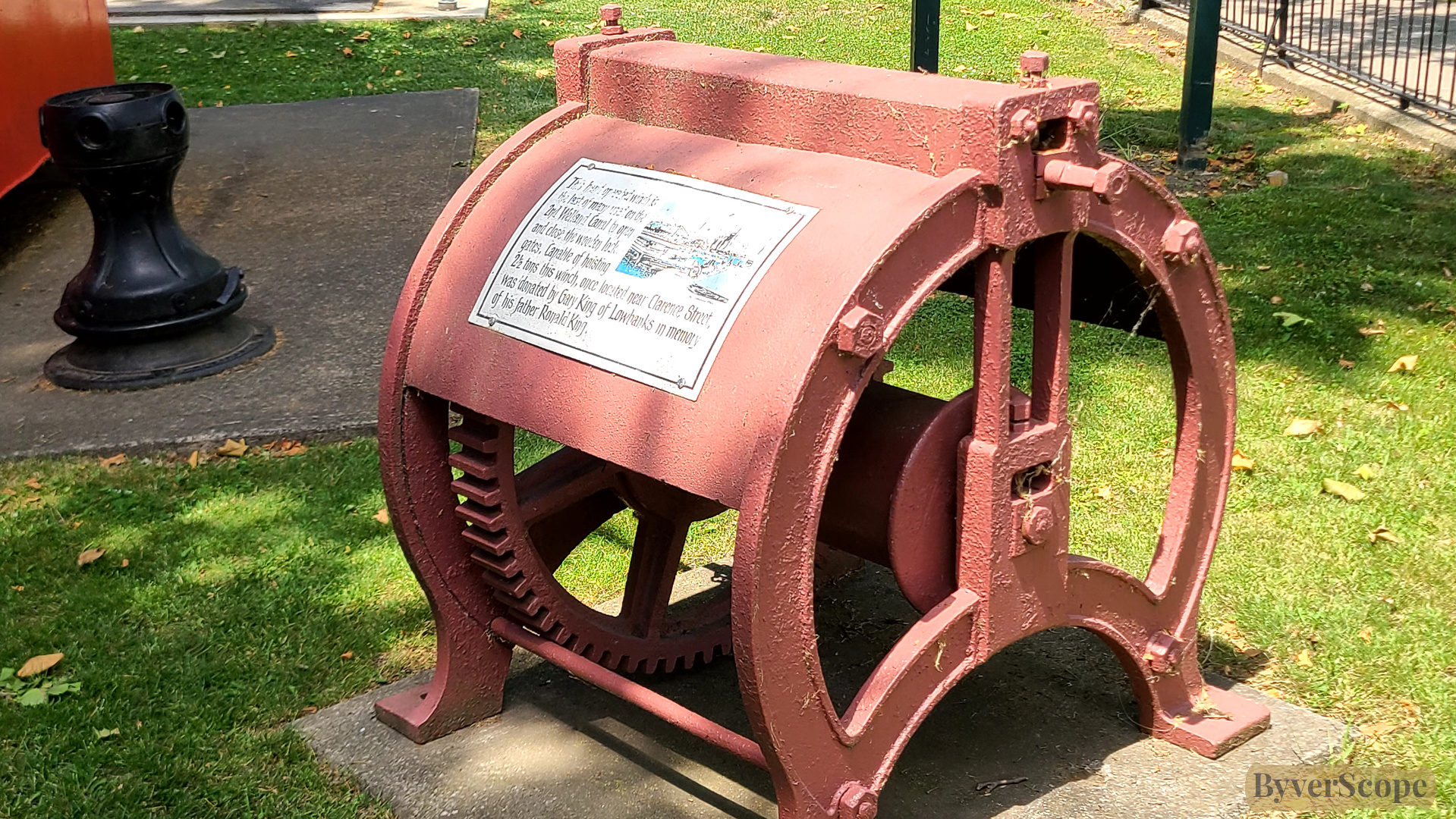
Enter the Historical & Marine Museum: Hand-operated winch once used to open massive wooden lock gates that could weigh several tons on the Second Welland Canal.
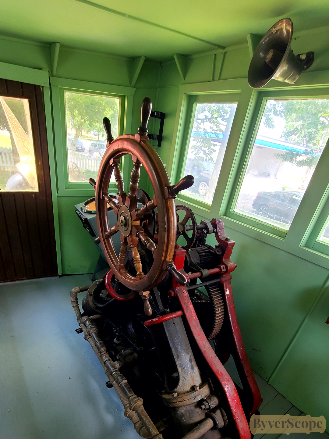
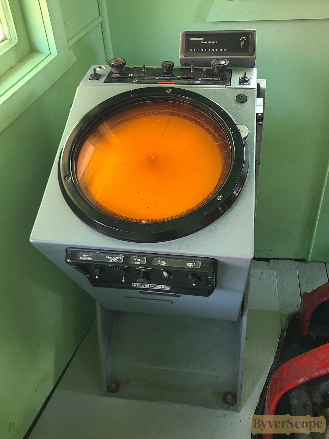
Steam tugs like Yvon Dupre Jr. were used to maneuver ships in tight harbour areas. On the Great Lakes, these vessels were essential before modern bow thrusters allowed large freighters to move sideways. (left) Wheelhouse controls from the steam tug Yvon Dupre Jr. with exposed gears. (right) Vintage Kelvin Hughes radar display — vacuum-tube era navigation technology built for harsh lake conditions. Early marine radar like this used vacuum tubes and phosphor displays, long before digital screens. Operators watched a glowing green sweep to detect ships, land, or obstacles — especially important in fog on the Great Lakes.
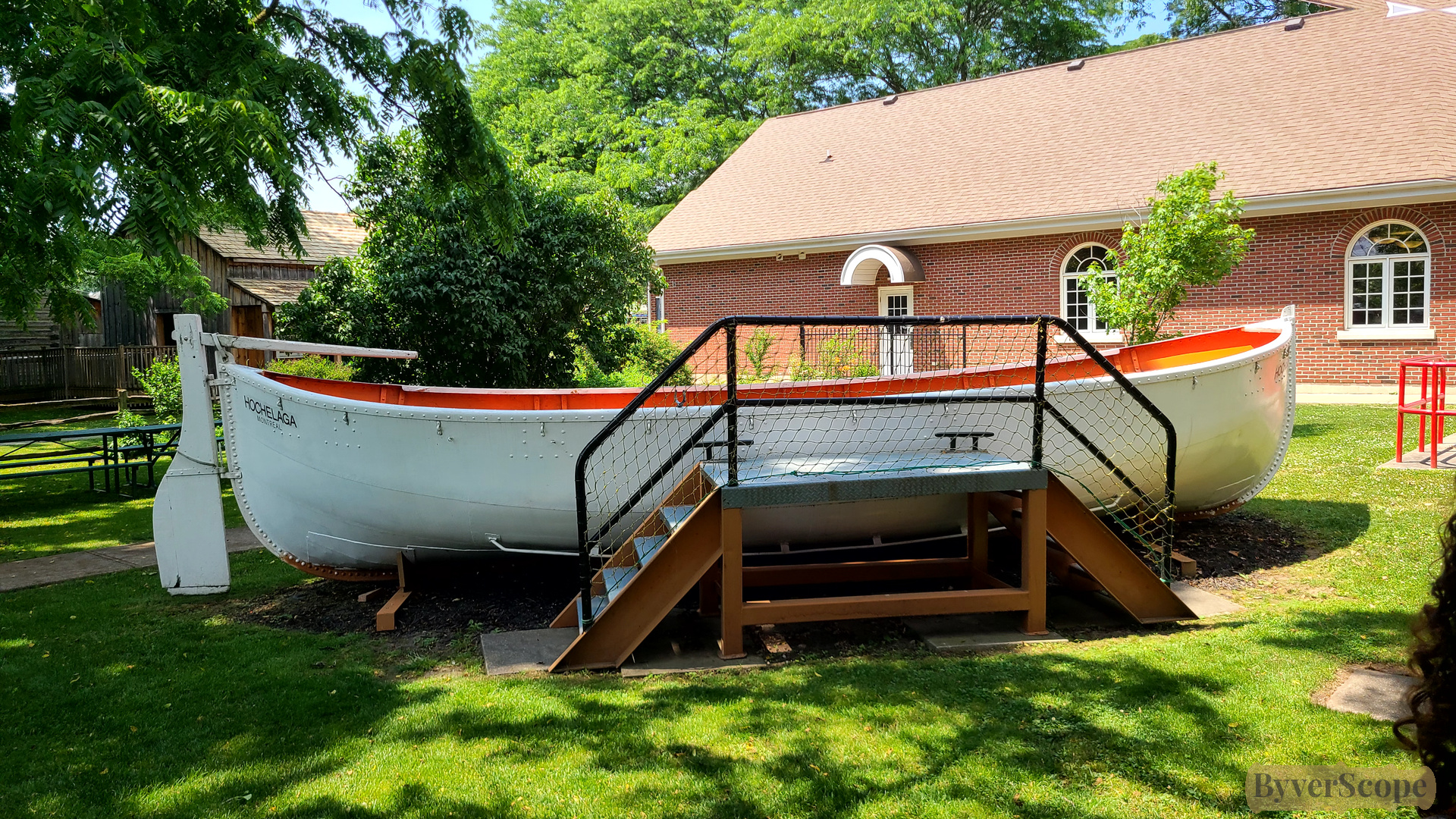
Original 50-passenger lifeboat from the S.S. Hochelaga (1949), preserved on the museum grounds. The S.S. Hochelaga, built in 1949 at Collingwood Shipyards, was nearly 640 ft long — making its lifeboat look surprisingly small by comparison.
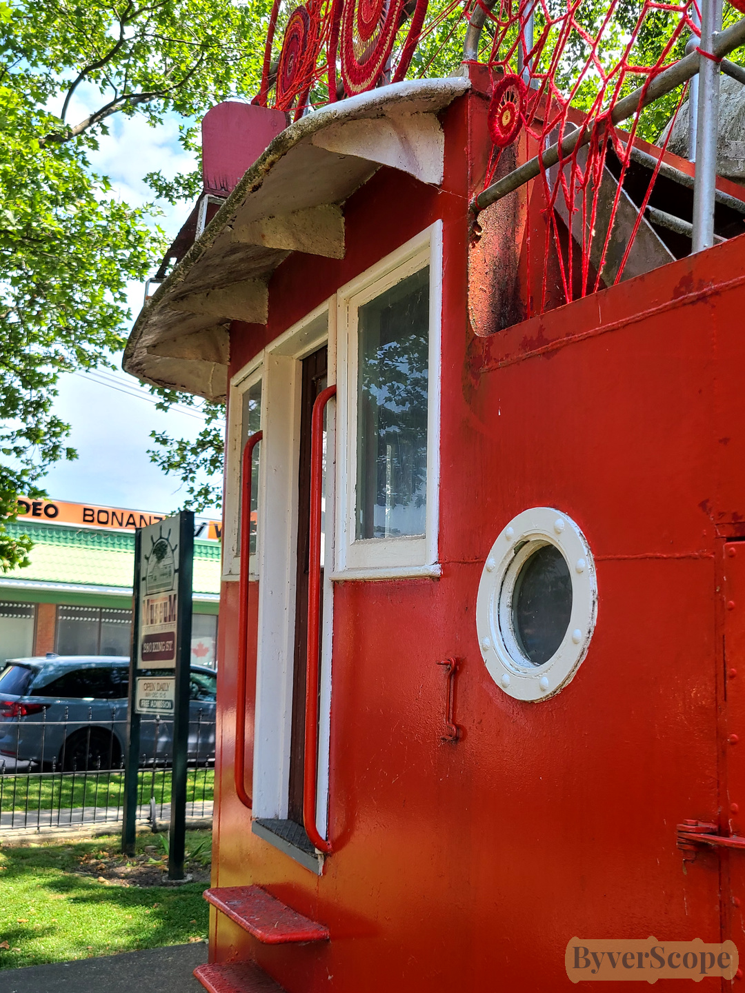
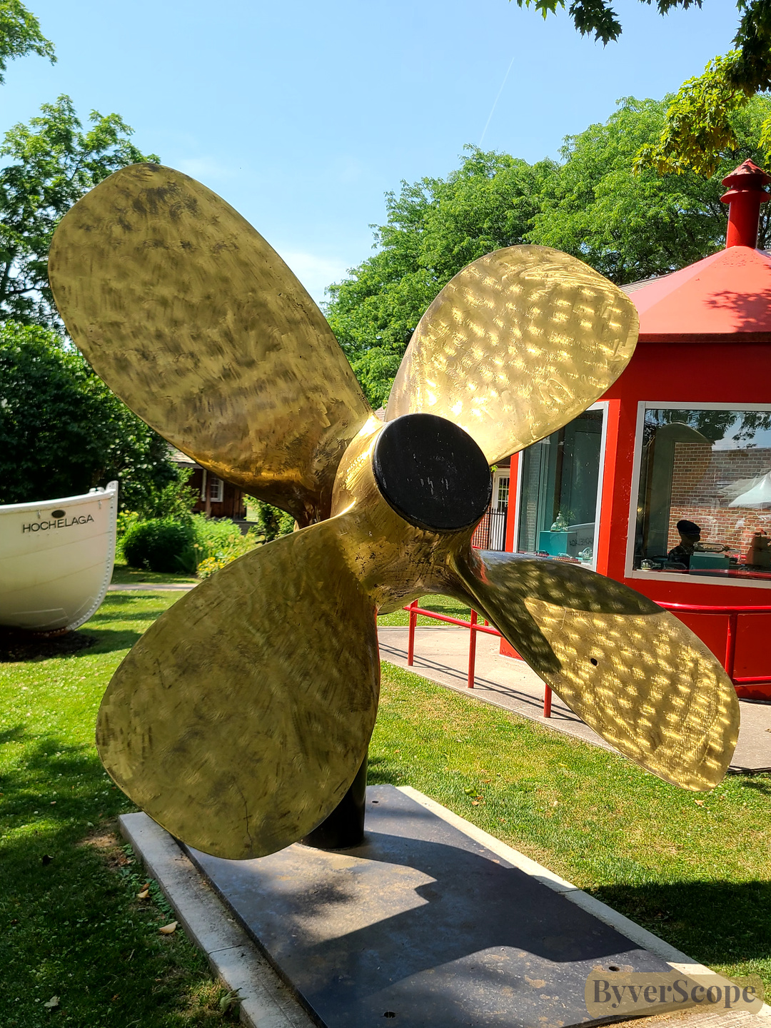
(Left) Entrance into the preserved red wheelhouse of the steam tug. Wheelhouses were designed to give captains 360-degree visibility. Many were painted bright colours like red so that crews could easily identify important control structures from the dock. (Right) Massive propeller from the S.S. Golden Hind mounted at an angle. Propellers from large freighters could weigh several tons and cost hundreds of thousands of dollars to manufacture. Each one was custom-designed for a specific ship’s engine and hull shape.
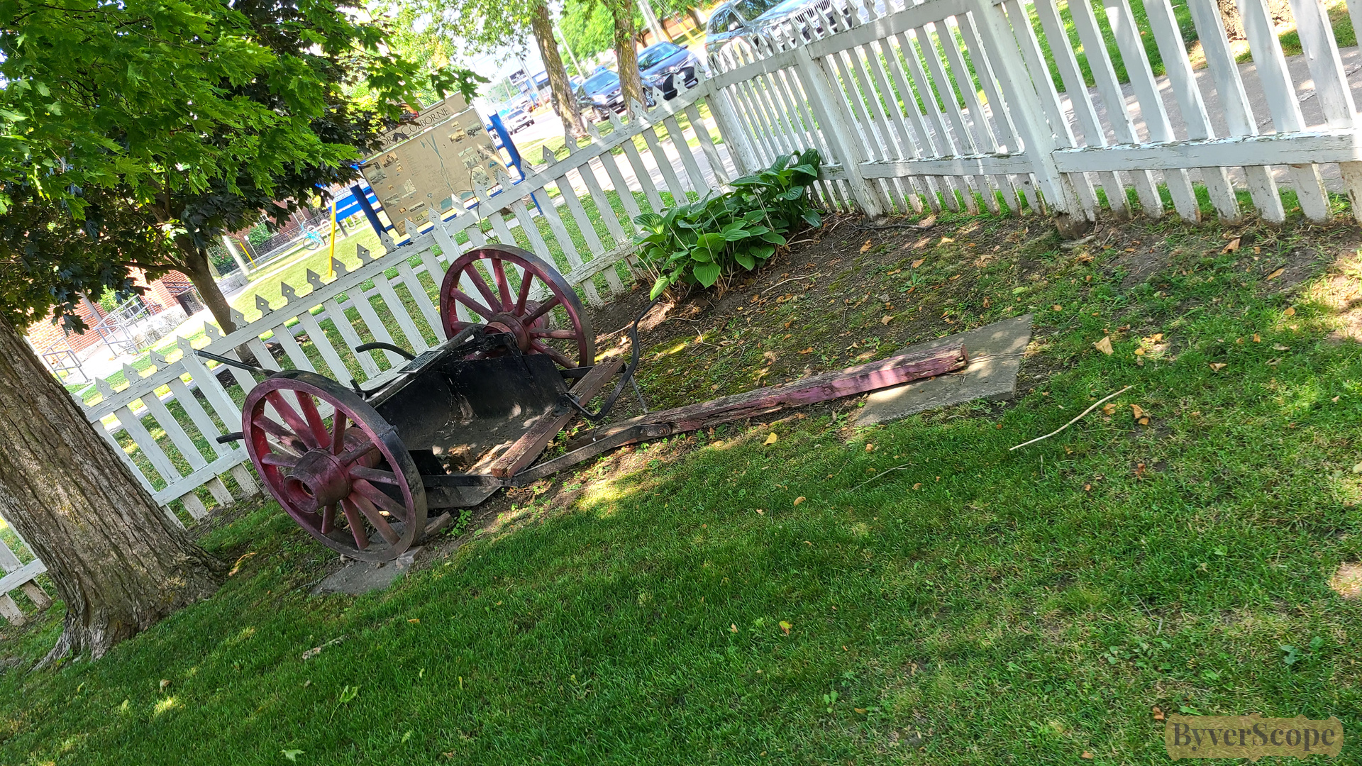
Earth scraper used during Welland Canal construction. The Welland Canal required millions of cubic meters of earth to be moved. Early canal digging relied on horse-drawn scrapers and human labour before steam excavators appeared later in the 1800s.
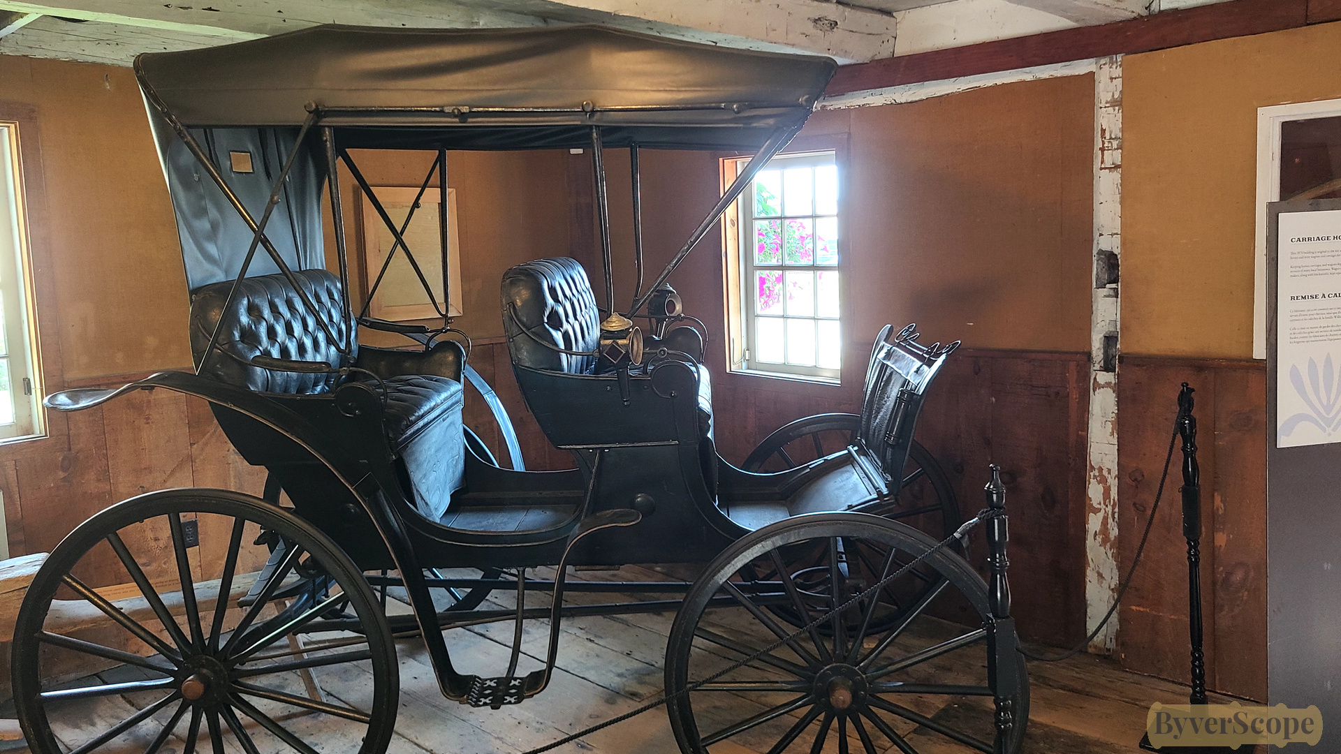
Horse-drawn carriage displayed inside the original 1870 carriage building.
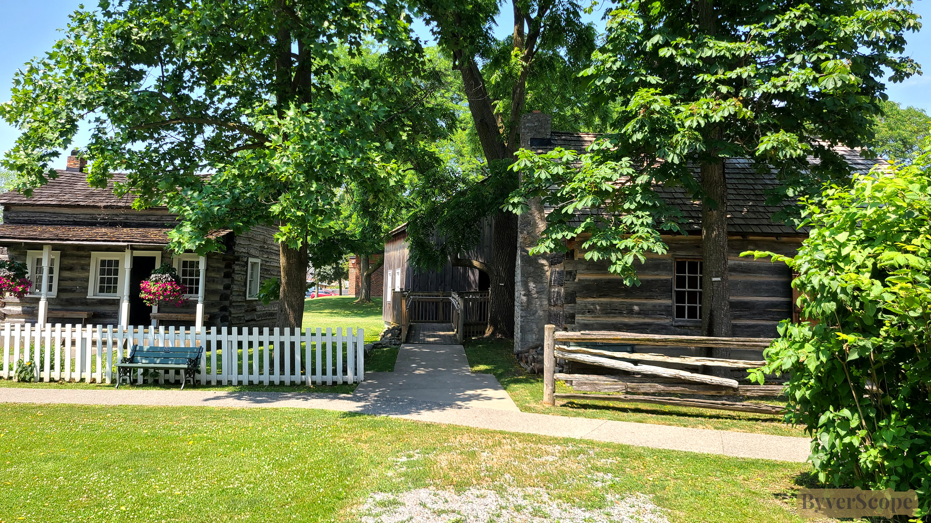
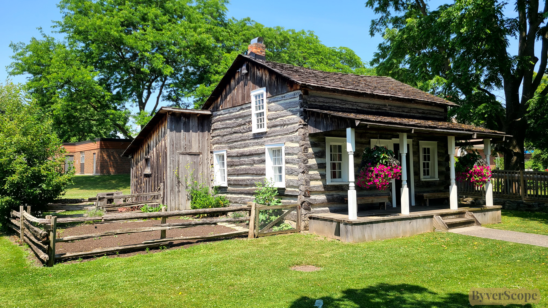
Two preserved log buildings side by side — fenced yards and shaded lawn. Buildings like these show how early settlers constructed homes using square-cut logs, often from local pine or oak. Many of these structures date to the mid-1800s canal expansion era, when workers settled nearby.
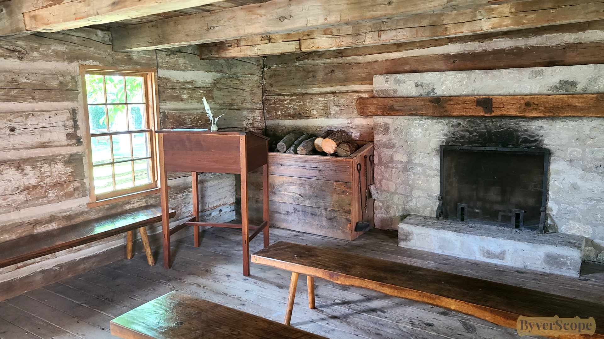
Interior of the mid-1800s log schoolhouse: wooden benches, inkstand, fireplace, low ceiling. Early rural schools were typically one-room schoolhouses. Students of all ages learned together, and older children often helped teach younger ones.
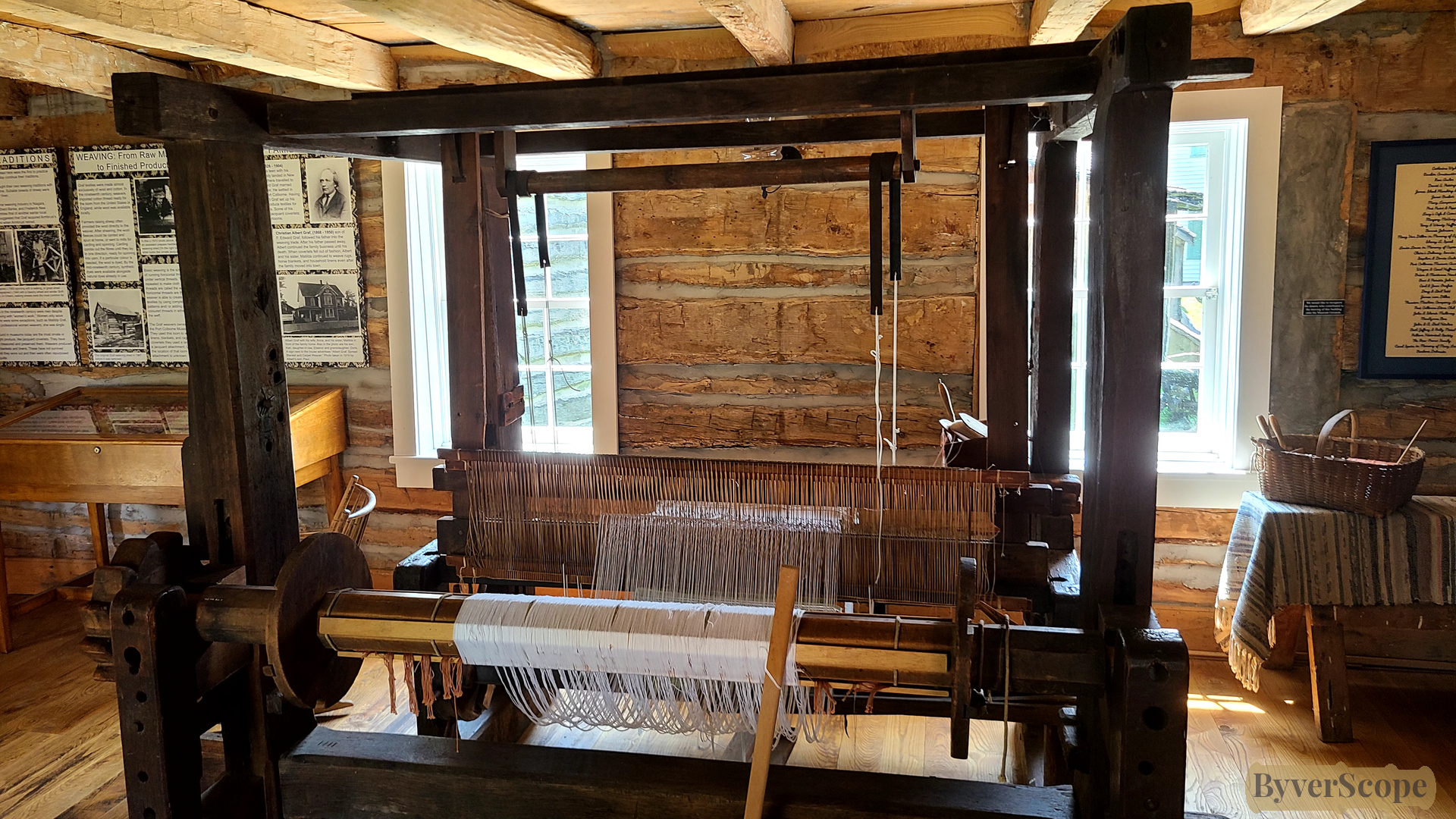
Large loom filling most of a log house room — textile work as household industry. Large looms like this were central to household economies. Families often produced their own linen and wool cloth, especially before railways made factory textiles cheap.
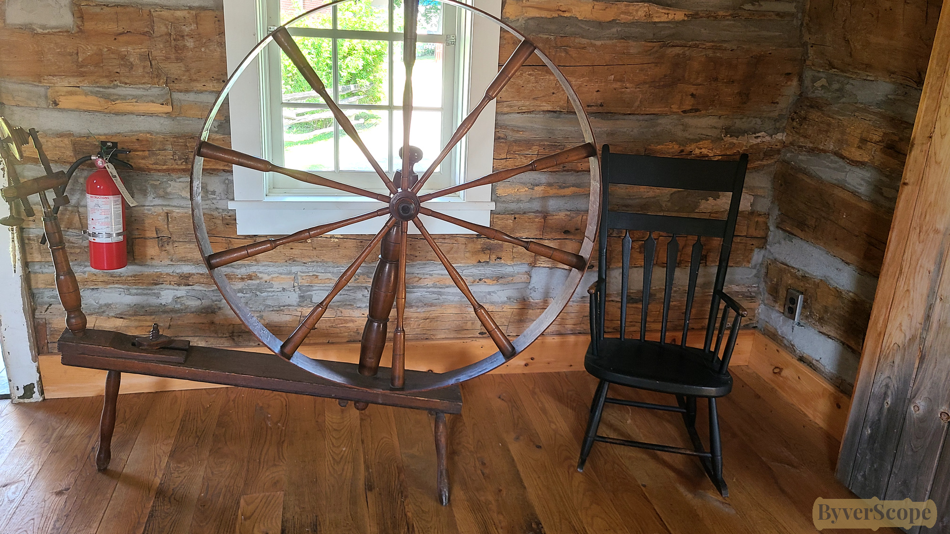
Spinning wheel and wooden rocker beside a window — domestic life preserved in place.
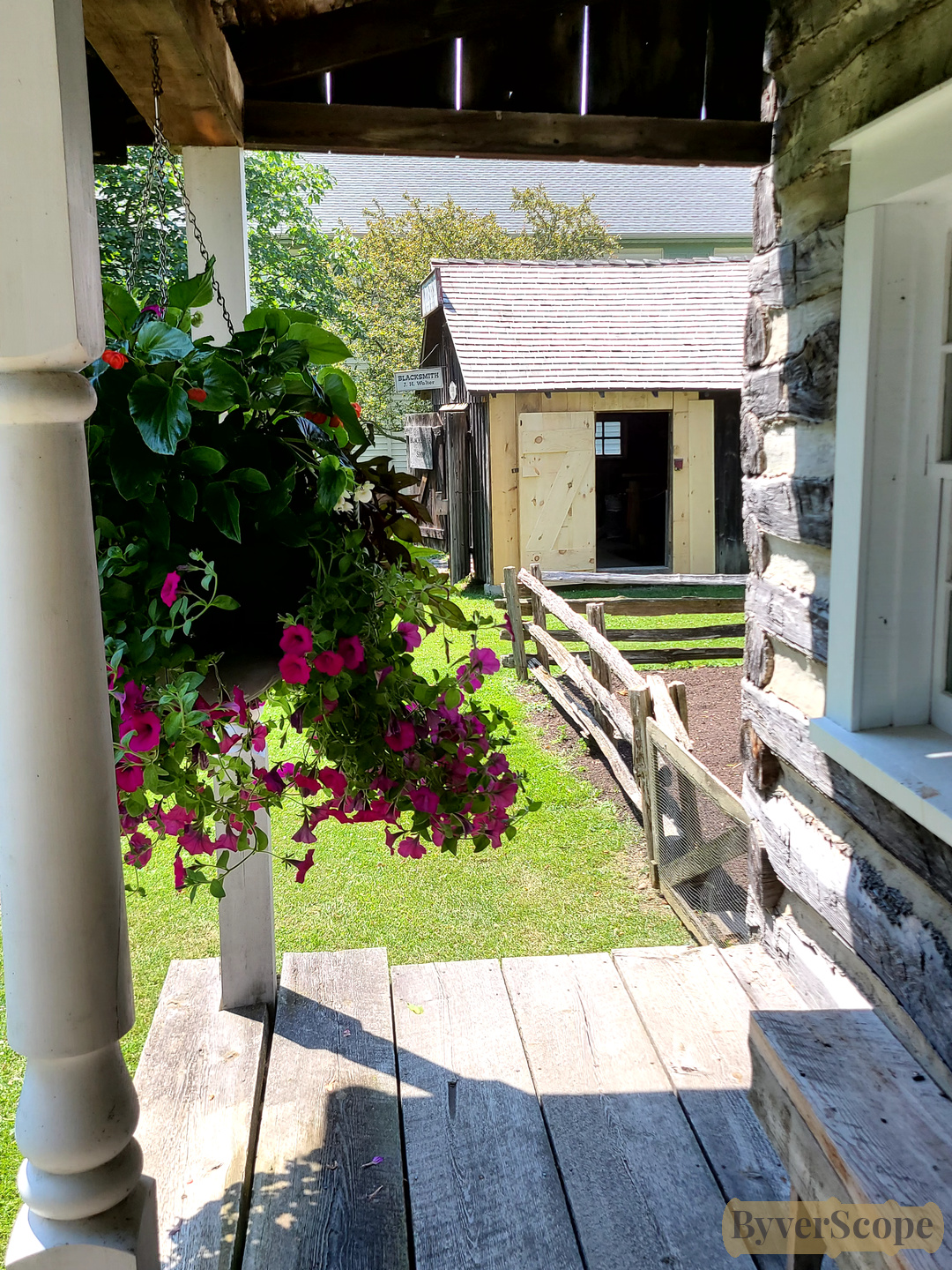
View from a log house porch: hanging flowers, plank floor, blacksmith shop in the background.
1850 log house exterior with small fenced garden and covered porch. Many homes in early canal towns combined domestic space and small gardens, providing food for families before large grocery supply chains existed.
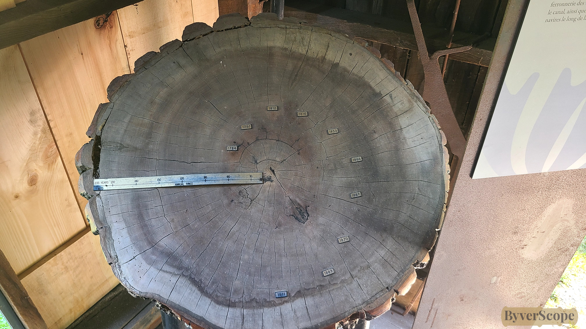
Cross-section of a 250-year-old tulip tree — rings marking centuries of regional growth.
Good to Know
- Start / End area: Charlotte St (St. James Church) → Canal Promenade → Marine Museum grounds
- Transit notes: Street parking near the canal; bridge crossings may pause traffic when raised
- Historical & Marine Museum: free to enter and dog friendly.
- Coffee / Washrooms: Cafés along West Street; washrooms at the museum (seasonal hours)
Spatial overview
Port Colborne blends heavy industry with careful preservation. Within a few blocks, you move from working canal infrastructure to 19th-century log houses and marine artifacts — a town shaped, above all, by water and engineering.
Join our newsletter
Stay updated on new areas, experiences, and travel inspiration.